
Choosing terrain carefully during B.C.’s February warm-up
As temperatures climb, a widespread weak layer is becoming increasingly reactive, catching riders off guard and elevating avalanche danger across many regions.
A significant shift in weather and avalanche conditions is underway across British Columbia. A strong warming trend is developing as an atmospheric river transports mild air into the province. Adding to the concern is a widespread layer of large surface hoar resting on a crust that has recently been buried across most forecast regions, an especially worrisome setup as temperatures rise.
Recent avalanche activity demonstrates how reactive this layer is. Both natural and rider-triggered avalanches have been reported, with several catching backcountry users off guard. Remote triggering has also been observed, indicating continued instability in the snowpack. Freezing levels climbed to around 2,000 metres early in the month in many areas and are expected to rise above 3,000 metres in the south. With periods of sunshine mixed in, conditions are likely to shift quickly toward a spring-like feel.
While some details remain uncertain, the overall trend is evident: avalanche danger is increasing, and widespread natural avalanches are possible. Along the coast, more rain will fall on an already saturated snowpack. The main concern stays in the Interior, where warm temperatures have yet to test this weak layer. With mild conditions expected to continue into the weekend, dangerous avalanche conditions are likely to persist across many areas. Looking ahead, a strengthening ridge of high pressure will keep conditions mostly dry while maintaining well-above-average temperatures across much of B.C. This pattern is expected to persist in the short term, representing a sharp departure from the colder conditions observed recently. For many areas, it will feel more like early spring than mid-winter. Confidence is growing that this ridge will start to break down Mid-February, allowing a return to a more typical weather pattern.
Interior B.C. weather and snow
Before the ridge fully settles in, the Interior will see a couple of weak systems moving through. On Sunday, Feb. 8 a cold front passed during the afternoon and evening, bringing a quick burst of snowfall ranging from one to 10 centimetres. Snow levels started near 1,500 metres before dropping to around 1,200 metres as the precipitation eased. Winds were moderate from the southwest to west-southwest and should stay below impactful levels.
Another system arrived on Monday, Feb. 9 as a warm front moved through, bringing some snow. This appears to be another short-lived, light event, with totals generally between one and eight centimetres.
Over the second week of February, snowfall was forecasted to be lighter, with about three to eight centimetres for Sun Peaks and five to 10 centimetres for Revelstoke.
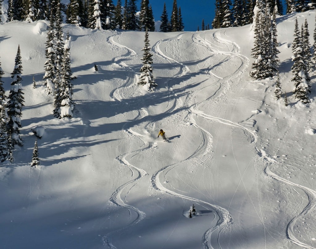
For skiing, you’ll want to stay higher in the mountains. Terrain above about 1,500 metres will have the best snow, while at lower altitudes it tends to feel wet, heavy or patchy as temperatures increase.
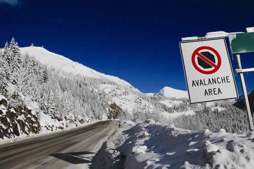
Staying safe in varying conditions
With so much change happening, relying on the information available to us is more important than ever. One of the advantages of recreating in B.C. is the variety of forecasting and observation tools at our disposal. Avalanche Canada’s Mountain Weather Forecast, Windy and YR.no are all reliable sources. Even DriveBC highway forecasts can provide valuable insights into temperature trends and upcoming weather. If it’s been a while since your last avalanche course, a refresher with a local provider is always a good idea—especially during seasons marked by persistent weak layers.
If you’re heading into the backcountry, preparation is key. Understand what the avalanche ratings indicate for your day out. High means natural avalanches are likely, and people are very likely to trigger slides. Considerable means natural avalanches are possible, and human-triggered slides are likely— conditions where small decisions can have big consequences. Moderate means that natural avalanches are less likely, but human-triggered avalanches remain a possibility, especially where weak layers are known. These ratings should directly influence your terrain choices and travel plans.
Staying safe begins with being well-informed and communicating clearly with your group. Be willing to adjust objectives as conditions evolve and let observations—rather than rigid plans—guide your decisions. Travelling in the winter mountains always involves risk, but slowing down and making cautious choices can significantly reduce it. Respect the terrain, keep an eye on each other, and be prepared to idle back when necessary.
What did you think of this story?
Your feedback after we publish a story helps ensure we're always improving our reporting to better serve you
Related Articles
Boaters reminded to keep speeds low near shorelines
Wakes can increase erosion and impact nesting birds, according to Ministry of Water and Lands and Resources Sustainability.
Glacier National Park trails remain closed following heavy avalanche season
Balu Pass trail, along with two others are closed indefinitely as Parks Canada staff evaluate how much of the popular trails will need to be rebuilt.

Regional district board backs sale of Revelstoke airport
The City of Revelstoke is seeking to retake ownership of the airport, which was sold in 1980.